Macchu Picchu

The Peru government began regulating entry to MP about 6 years ago, so now 1). you must have a guide, 2). your entry is timed so that the number of people present at any one time is limited and 3). your time inside is limited to 2 hrs, theoretically, and the guide is responsible for keeping track, and 4). you must keep to the route assigned to you on your ticket. We had 2 tickets, one for route 1 and one for route 3 but both allowed entry at 10AM. The guides are somewhat lax about enforcing the two hour limit.

The site is spectacular, both the views and the history.

Hyaena Picchu juts up above the “lost” city
residential area

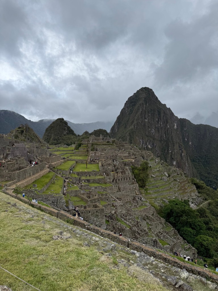
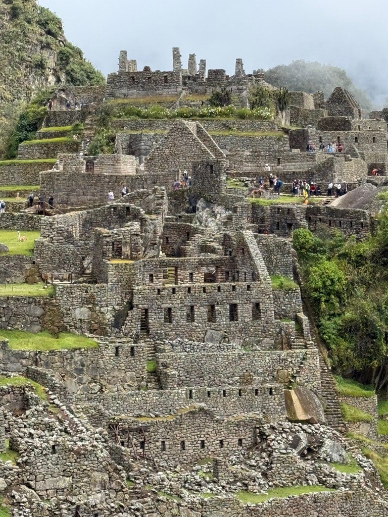
According to our guide, archeologists say construction started in late 1400’s and the site was abandoned by the Inca in early 1500’s. It was actually occupied for only about 30 years with never more than 700 people living there. All of that is hard to believe. The amount of work to create this would have been enormous. Consider that these stones were created by hammer and chisels, before the iron age, so hammers crafted out of stone, chisels made of copper?, or stone. And the terraces you see in these pictures are just part of what they created. More terraces are covered by the jungle at the bottom of the hill, they haven’t been exposed by clearing away the vegetation. The terraces were to stabilize the hillside and to provide agricultural space.All the buildings would have had thatched roofs.

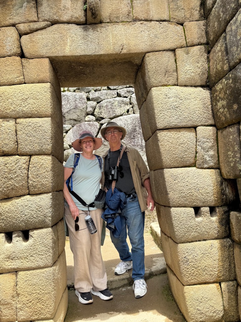
Most stones are roughly fitted together and the spaces between filled with mortar made from clay, sand and ashes but the upper classes, kings and priests, lived in extremely well fitted, smooth stone structures like this one. Notice the pair of holes chiseled into the stones on each side and a loop sticking out above the door. These are where ropes were used to hold a door in place. This was the entrance to one of the temples.

These channels were carved/chiseled into the

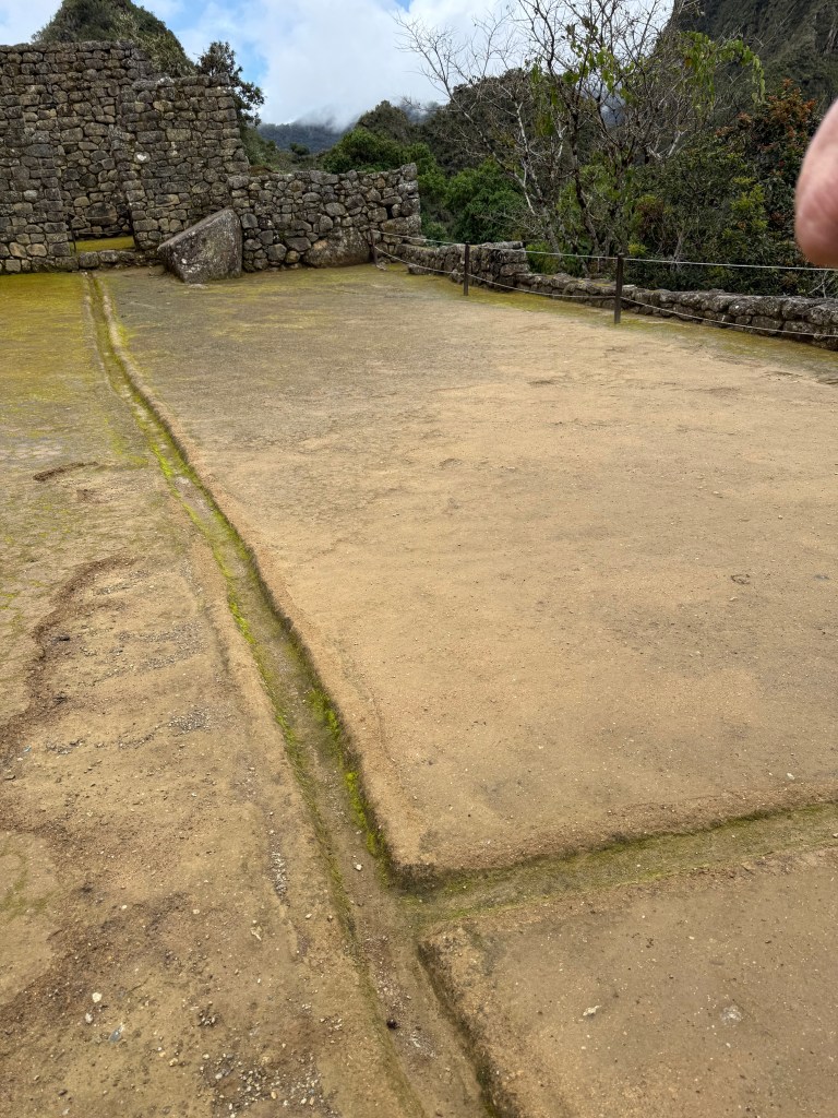
stone in order to channel running water through out the village.

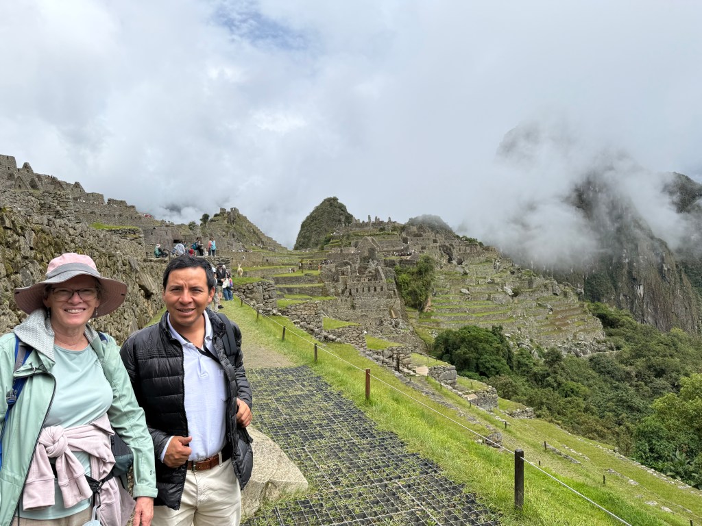
This is Peggy with our guide Hugo. We stayed from 10AM to 1 PM, all on route 3 which crisscrosses with route 2. We could have done route 1, we had a ticket, but we were tired and had seen 90%.

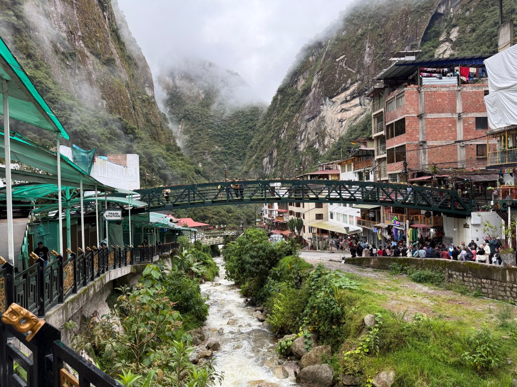
We watched hummingbirds at a feeder while we had a light lunch in the restaurant of the only hotel next to MP, then the bus took us back down the mountain to Agua Caliente. When there we discovered Tripmaster had arranged for a lunch for us, after that we boarded the train back to Ollyantaytambo where a driver met us and drove us to Cuzco.

We spent that night, our last at Saska Boutique hotel. Walked around the central district and ate supper at Ofrendo. Our long day and a half of flying, Sunday 3/8, started the next morning,. We flew into Louisville and arrived home 3/9 at 1PM.

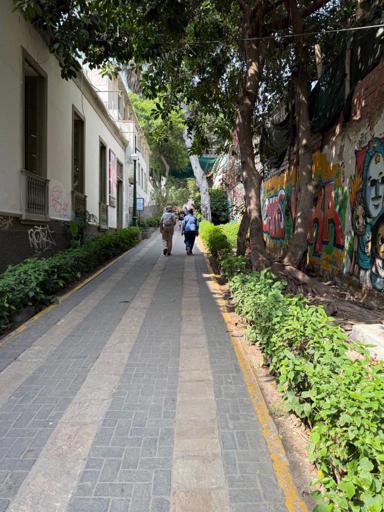
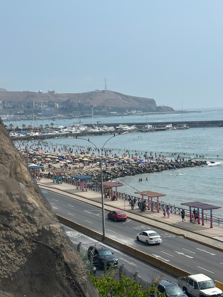
Notes on Peru: if you go, don’t even think about driving in Lima, use Uber or taxi. Their driving is insane. Also don’t expect people to know English. I think none of our Uber drivers did. Restaurants frequented by tourists will have some English speakers but most we ate at had little to none. Also, Peruvians in general couldn’t understand my broken, accented Spanish nor could they slow down their speech to accomodate me by using simpler words. Finally, Peru’s food reputation really is deserved. We didn’t have a bad meal, and the dishes we had at Ayahuasca Grill in Agua Caliente, for around $13 each, was one of the best meals I have ever had.

Valle del Salgrado

At Cusco airport we were met by a representative of Tripmaster who simply recognized us by the confused looks on our faces. He escorted us to our driver, gave us our many tickets, and departed. The drive to the Sacred Valley was 2 hrs., we arrived at Hacienda del Valle Sagrado (Sacred Valley) at 11 PM. This day started with bird watching in a wetland outside Lima, and ended several hundred miles away in the Sacred Valley. The hotel was an immaculate, interesting hotel, with almost no guests. Here’s a picture of the inside, looking down toward the lobby from our room:

Hacienda Valle del Sagrado lobby from above

The next day, Thursday we had breakfast, walked around, swam in the pool and decided to take a taxi to Ollantaytambo, about a 15 minute drive, a quaint Inca pueblo with ruins on the hills above the town.

Grain storage buildings on the mountain side
The Incans had a penchant for building terraces
Where we had lunch

We went back to the hotel, that evening had supper, we were the only people in the restaurant, and went to bed early as our train to Agua Caliente, the embarkation point for Machu Picchu, was to leave at 5:15. We packed over night bags, tagged them to go to our hotel in Cusco on Saturday. A driver showed up as we were told one would, we got to the train station tickets and passports in hand about 5:45, boarded and set out for Agua Caliente. You can’t drive to Agua Caliente, it’s either train or a four day hike on the Inca trail. We chose the train. Our guide for the day was there to meet us as we got off the train, he walked us to our hotel, Taypikala, where we killed about an hour bird watching and resting in the lobby (our Macchu Picchu tickets were for 10AM). He came back and took us to the bus to Maccu Picchu, a 25 minute switchback drive up a steep mountain. We needed round trip tickets for the train, round trip tickets for the bus, and tickets to enter Macchu Picchu. Tripmaster provided all those and had someone to meet us at each critical spot, and a box breakfast for us on the train to Macchu Picchu. The bus left to go up the mountain around 9:30, we started our tour at 10:15. Here is a pic to give a flavor of Agua Caliente, no cars, but lots of people, hostels, stores and restaurants.

The town of Agua Caliente on both sides of this stream,. It enters into the Urubamba river at the mountain straight ahead.
Large stones at the small plaza at the base of our hotel were left in place and carved. On the left is earth mother giving birth to ?, mankind?. On the right is an Incan boy, ? her offspring?

There is a hot spring not far upstream feeding into this. We didn’t have time to walk there. Macchu Picchu next post.

Peru !

Uber Fails: Getting to Lima was a chore. We had trouble scheduling connecting flights so had to stay the night in Miami on 3/1, check in 11 PM, leave 5 hrs later. The Uber we scheduled before going to bed was a no show, but we realized it quickly and had one there to get us only 20 minutes later. We breezed through the Miami airport and were on our way. We waited about an hour in a long immigration line in Bogota only to find it was the wrong line. We found the correct line and still made our connection to Lima with time to spare. But going from the Lima airport exit to get the Uber we called for was an experience. At the end of the cross walk which you must take leaving the airport are a dozen or more nice cars with Uber signs on them, and dozens of well dressed young men with Uber logo shirts accosting you to get in one of these cars. Something didn’t seem right about it. Well for one, none of them was the person we called. These well dressed professional looking men insisted they were Uber but were closer to the airport than the official Uber pick up station. I was about to throw in the towel when Peggy saw a slovenly, unfriendly guy walking towards us. He was our real Uber driver. I asked him about all the young men we were walking away from, he matter of factly said “Oh, they are the illegal Ubers”. This was late Monday afternoon 3/2. We got to Holiday Inn Miraflores around 6:30, and ate a block away at Rasto’s where I had my first authentic Peruvian Lomo Saltado.

Lima: Tuesday 3/3 was a half day city tour in the morning. Here we are at the Basilica de Lima, left, and outside the municipal building with our guide Aura, right.

Our guide Aura, ethnic Chinese. Lima has a very large chinatown. Ayesha, our friend for the day is in the picture as well

Much of this tour was walking through the San Francisco Church, Monastery and catacombs. Hundreds, maybe thousands, of skulls stacked in the catacombs under the church. For about 2 centuries, mid-1,500’s to about 1,800 it was the only consecrated burial grounds so everyone got put there. The smell of decomposing bodies got so bad a new governor of the province designated a new burial ground made “kosher” by the catholic church ending the practice of entombing bodies under the church.

Skulls and long bones excavated from the catacombs under the church

The tour dropped us off at Parque de Amor, Love Park. We teamed up with Ayesha, a single women on the tour (her husband was in a business meeting) and went for lunch at Republica del Pisco, seen here:

Peggy and Ayesha walking down a street in Barranca

Notice the effigies hanging above. They seem to have a fascination with el muerte in Peru, no idea why. We walked around Barranca, an artsy neighborhood, then headed back to Parque de Amor. These are the views of Lima, a city of 12 million, from the cliff overlooking the ocean.

Peggy with Ayesha, Love Park in the distance
Close up of the beach seen above just to the left, the only sandy beach, very popular

The beach is only a few yards deep and rocks, not sand but the few sandy spots are jammed with people. Here is the famous, semi-pornographic statue at Love Park:

And a pic of us in the photo spot with the statue behind us.

Looking at these pictures it’s surprising to think that Lima is in a desert. It last rained 3 years ago, and the previous rain was 11 year before that. The city is completely unprepared for rain. There are no storm sewers to take rain water away, all roofs are flat. Fresh water is not in short supply however, rivers from the Andes provide enough water.

We ate at Rincon Shami that night, a place an Evansville acquaintance of mine who is originally from Lima recommended. It’s not a place we would have ever picked ourselves but was very good. We ate at a sidewalk table and an SUV slammed into a bollard about 10 feet away from us providing a little excitement.

We went bird watching at a wetland just south of Lima on Wednesday 3/4, Refugio los Pantanos. No pictures, we saw 35 species, 17 life birds for me.Went back to town around 2 PM, ate at el Parquetito along Kennedy park, a two block urban park renamed for JFK several years ago. I saw two life birds there, Cordilleran Parakeets and a Southern Beardless Tyranulet. We got our luggage from the hotel and headed to the airport for Cuzco. Got to the airport in plenty of time even though our Uber driver was pulled over by the police, reason ???, we never knew.

Savannah…

…a beautiful city, the second busiest port on the east coast, well worth a visit. Savannah is a success story. Thirty years ago it was run down, dirty and plagued by crime. Things slowly began to change. No one I spoke to seemed to know the exact reason but probably control of crime played a big role, the coming of SCAD (Savannah College of Arts and Design from its beginning in the ’70’s to 16,000 students now), some hit movies and historic preservation and tourism all combined to start the snow ball rolling down the hill leading to an avalanche of improvements. Today Savannah rivals Charleston for beauty, southern culture and tourism. Pretty much any random street in Savannah looks like this:

Live oaks, their tendency to horizontal spread creating an archway over the street complete with an adornment of Spanish moss.

We left home Sunday 11/2 at noon, made it to Dalton, Ga. From there to Skidaway State Park at 4:00 PM Monday. This is our campsite:

After checking in and setting up we took a 2 mile hike on a trail that went through slightly elevated woodlots alternating with boardwalk through salt/brackish water marshes. Tuesday was our Savannah day. It started with a tour on the Old Town Trolley:

Trolley seen passing the Basilica of St John the Baptist

The quality of the 1 1/2 hr. trolley tour depends greatly on the quality of the driver/guide. Ours, Big E as he calls himself, was wonderful. Funny and informative, we were lucky to get him. Since the trolleys are hop-on-hop-off, Peggy took a different one back and experienced another driver/guide. The guide can make a big difference. After the trolley tour we walked along River Street, had lunch at “Two Cracked Eggs”, then walked down Bull Street where Savannah history is on full display. Here pictured below is the center of southern commerce in the first half of the 19th century. This building on River Street was where nearly half of the world’s cotton was bought and sold.

The Savannah Cotton Exchange

From there we took a pleasant walk down Bull Street to a little beyond Forsyth Park, total about 2 miles. The restored historic houses are a treat to see, and there is a “park”, or public square every two or three blocks, each dedicated to an important historical figure from Savannah’s past. This synagogue pictured below, built around 1830, represents a jewish community established in the early 1700’s. Like the Jews of Newport Rhode Island the Savannah jews received a letter from George Washington but unlike the more famous RI letter in which Washington writes – the children of Abraham should enjoy “the exercise of their inherent natural rights. For happily the Government of the United States, which gives to bigotry no sanction, to persecution no assistance, requires only that they who live under its protection, should demean themselves as good citizens” – the Savannah original is lost.

picture taken from the public square opposite the synagogue, it’s hard to get a picture in Savannah without live oaks being in the way

We stopped at The Sentient Bean for coffee and tea, Savannah loves coffee houses, then Peggy took a trolley back to the car, I walked a little farther on then walked back to the car. We ate at Cary Hilliard’s, a local chain, which has eat in car or order from a car-hop and carry out.

Wednesday we went to Tybee Island, Savannah’s beach. The beach was nice enough but we aren’t beach people, and they don’t allow dogs on the beach so we skipped it. Fort Pulaski national historic site was on our plans but it was closed due to the government shut down, we forgot, wasted a drive. Finished the day with an excellent meal at Sundae’s, a Guy Fieri rec.

Thursday started the day at Wormsloe. Founded by Noble Jones a member of the original 114 settlers brought to Savannah by Oglethorpe in 1733 to create a new colony which would serve as a buffer between Spanish Florida and South Carolina. Oglethorpe had investigated England’s debtor prisons and became very disillusioned by what he found. He obtained a charter from the king and brought mostly unemployed debtors to his new colony. The idealistic Oglethorpe banned slavery and alcohol, gave each colonist 50 acres and intended a kind of utopian community. Another 400 settlers, again mostly debtors, came in 1733 two years after the first group, but despite the eventual success of the new colony, Oglethorpe’s vision for it was a failure. Here is the image of Wormsloe everyone remembers. The over one mile long entrance to Wormsloe is lined by hundreds of live oaks planted in about 1891?. Each is 33 feet apart, and 66 feet opposite each other across the lane.

Wormsloe was originally 5,000 acres, direct descendants of Noble Jones still live on a portion of the original land, but most is now a state owned historic site. From Wormsloe we went to Bluffton, S.C., a small town on Hilton Head island, to their farmer’s market. Supper was back in Savannah at Erica’s Low Country, very good local food.

Friday we went to the Savannah botanical garden, quite small, essentially a project of the local garden club, then we ate lunch at Kayak Kafe, got cookies at Byrd’s Cookie Co., both local chains, and then hit the road.

One life bird, Clapper Rail, on the marsh trail at Skidaway park.

Gibbs’s Garden. Visiting this was always a part of our purpose on this trip. We have been to a lot of garden’s on our travels, Duke University’s was fantastic, and Montreal has a very nice one, but for shear beauty nothing tops Gibb’s Garden. Located in the north Georgia foothills of the Appalachians, the scenery is stunning.

This isn’t the usual ‘learn about plants’ garden, there were almost no identifying name plates. This garden is about landscape design. It is intended to have four season interest and I hope to see it again in each season. Notice the row of crepe myrtle and daylilies in the small right side photo, that would be spectacular in summer. Some of the hillsides have thousands of daffodils blooming in spring.

Lastly I want to mention Puckett’s Grocery in Murphreesboro Tn. where we ate supper Saturday evening. Good food, and a ‘rising star’ performs country music most nights, and every weekend night.

Montreal Day 3

Thursday 8/7/2025

Today’s schedule was a Steve and Peggy day. We picked Montreal’s botanical garden and insectarium. Both are fabulous, the latter is more out of the ordinary, after all lots of cities have botanical gardens. They are located on the same property literally in the shadow of the olympic stadium built for the 1976 games.

That’s the stadium tower looming over their heads, the biodome is on the left side. They are looking toward the botanical garden. The Botanical gardens are both inside in greenhouses, like the picture below, or outdoors. A variety of garden themes are present from herbs and vegetables to bromeliads. We had only scratched the surface in about 2.5 hrs when it was time to go to the insectarium (they assign times to prevent it from being mobbed with people).

Tropical room

The insectarium had numerous displays like these three…….

The butterfly displays were arranged mostly by color, the number and diversity of beetles is other-worldly.

The grand finale of the insectarium was the butterfly room. One of the best we have seen it was filled with a variety of mostly tropical butterflies. After a nice lunch at the gardens we went back to regroup before supper at Pub Wolf and Watchman, very good food, and they allowed dogs. And then we walked around observing the considerable night life going on in the downtown port of Montreal area.

We came across these two opposing statues in the square representing British snobbery and French aloofness. Here they are, taken at night….

With their noses in the air so they can look down on Notre Dame cathedral in the case of the Englishman, and an important English bank in the case of the French woman, neither is aware the dog they hold are bonkers each for the other. She holds a poodle, he a bulldog. Kevin and Jackie doing their best poses beneath.

Montreal day 2

Tuesday 8/5/2025 was a travel day, after dropping K & J off at Holiday Inn Centerville we had a devil of a time getting parked and into our vrbo. I finally decided to take the car top carrier off and carry it into the room. That way we could use the building’s underground parking. K & J had a spa day and date night at a local eatery. We walked to an Irish pub and ate on their patio. Today, Wednesday the main activity was a tour of Habitat 67, as in 1967. Built for the world’s fair, it is one of the few structures still standing from that fair. Concrete slabs were fabricated on site and lifted into place to form cubes, each about 600 sq. ft. The idea was to create a community in which people would live their entire lives, one cube accommodates a single adult, two a married couple, 3 or 4 for a family, back down to two when the kids move out, then one…..and so on. Built on an island across the St Lawrence from Montreal it does have some stunning views. Below is Peggy approaching Habitat 67.

A “picture window” view at street level from inside central courtyard, standing under a cube.

It feels like a jumbled maze of concrete inside. This picture is from the second floor looking up and across to other units.

A picture from the top of one unit looking across to another jenga like cluster of cubes.

It does have some great views.

Inside the units does feel private and quiet. The affordable housing community idea never worked. The units are privately owned now, sell in the millions, $4,800/mo fee in addition to whatever the mortgage is. Only the super rich live there now.

Below is the biosphere designed by Buckminster Fuller, like habitat 67 it was a structure created for the ’67 worlds fair. Lunch was a picnic in the park where the Biosphere is located.

Afternoon was spent walking in old Montreal and visiting the History of Montreal museum. Evening meal at L’original.

Whales !!!

Monday 8/4 was our day to see whales. It was a 2hr 40min drive to Baie-Saint-Catherine, where the Sagueney river flows into the St Lawrence. With Tim Horton’s coffee and a few pastries from Cruquembouche (Peggy’s new favorite place in the whole wide world) we made the drive with plenty of time to find an ideal spot to park leaving our dog in the shade (it was 65 degrees outside) and still be early for boarding. We had been told by our guide the day before not to expect much but things looked promising when Jackie spotted a seal while we were still waiting to board. We hadn’t been on the boat more than two minutes when we spotted beluga whales. The population of belugas in the St Lawrence is not migratory, only about 2,000 remain here. They were easy to see, the adults being all white, but the boat isn’t allowed close to them. In a few more minutes we saw our first non-beluga, a Minke whale. This one was about 30 feet long. Hard to photograph, they suddenly appear, spout or splash then dive again….

Minke whale, ship’s guide estimated him at about 30 feet. The surprisingly small fin is near the very back of the whale.
Minke whale, briefly surfaced. The splash he made was as impressive as the whale.

No pics of belugas. Although fairly easy to see they look don’t show up well in pics taken from 2 – 300 yards. We thought we had 3rd class seats but when the attendant saw our tickets he called for back up. Someone came and escorted us to the top deck.???

While the top deck was great with 360 degree views and looking down on the whales, the lower decks were nice to escape the constant wind and cool temps.

Going up the Sagueney river, they call it a fiord., and eating our box lunch. We had the best looks at beluga whales here.

The cruise was 3 hours, about the right amount of time. We stopped at Montmorency falls on the way back. Much higher than Niagra falls its obviously not as wide. An early location for hydroelectric power (late 1800’s) it no long has a turbine.

On the boardwalk to the falls observation deck. Notice the wooden stairway that climbs the rock beside the falls. We climbed to the bottom roofed platform..

We climbed part way up the staircase to an observation platform.

The walk makes a circle and takes you to the top of the plateau where you can walk over the river, see the footbridge above the falls.

Ate at a ramen place near our hotel later that night back in Quebec city. Breakfast again at Peggy’s favorite place in the whole wide world, then packed, picked K & J up at the Clarendon and headed for Montreal. Ate lunch at the place pictured below, truly local, basically they only sold poutine to diners, they also sold cheeses for take out but all we saw people buy were very large bags of cheese curd, ?to make poutine at home? …..

Drove on to Montreal where I took the car top carrier off and put it in our hotel room so we could use the free parking beneath our hotel.

Quebec !!!

We started this trip in Quebec city. Kevin and Jackie were to meet us Saturday 8/2/2025 at the airport then to Chez Victor, a small restaurant chain specializing in Quebec style foods, burgers and poutine. But that wasn’t to be as there were intense thunderstorms in the area. They were forced to land in Montreal, finally arrived a little after 10PM. A&W was their first meal.

Kevin and Jackie stayed in Hotel Clarendon, in old Quebec, it’s located about 2 blocks from the most photographed hotel in the world, the Fairmont. We stayed at the dog friendly Hotel Pur.

Hotel Clarendon
The Fairmont, picture taken from the citadel of Quebec. This hotel is massive, is the center point of old Quebec. Built in the late 1800’s the tower was added in the 1920’s. When transcontinental travel was by rail, this was an important stop. Dufferin’s walk is between the hotel and the cliff edge. Buskers are always on the walk, an outdoor performance is going all weekend between the Fairmont and the walkway. The St Lawrence seaway is on the right horizon, there are great views of it all along the walkway.

Sunday morning started with a guided tour of old Quebec. Our guide, Diane, is enthusiastic about Quebec city. We started near the St Lawrence river, and slowly made our way up hill. Here is our guide in the left picture, Fairmont hovering over, 96 umbrellas suspended in the background.

The umbrellas better seen here
Our guide, umbrellas immediately above, the Fairmont high above, a typical post card scene.

The streets were filled with art; gallery’s, murals on the buildings, displays and finally the profusion of flowers in bloom are art as well. Here is a mural from 2022 depicting scenes from Quebec history:

Top to bottom the four seasons are depicted. Joliet, explorer of the upper Mississippi river is in the lower left.

A closer look shows de Champlain who founded Quebec City thus creating New France in 1608 just above Kevin’s left shoulder. Lord Dufferin, governor of Canada in the late 1800’s and savior of Quebec’s walls on the far right. In 1874 the city’s business leaders and elected officials decided the walls were no longer needed and were ‘in the way’ of Quebec’s expansion but Dufferin argued against and prevailed. He is celebrated in Quebec City today for that, as well as his general good governance of Canada. The walkway along the cliff overlooking the St Lawrence is named for him.

Flowers are every where, in large pots, in window boxes or in beds like this one:

Flower bed and cobblestone street

We could have placed ourselves better inside the frame, composition is lacking, but another opportunity for a postcard-like picture.

The city tour made its way gradually upwards until it was time to climb the breakneck stairs, so named because in their earlier days the wood was often rotten or slippery. Totally replaced since then, the wood is sound now, but the name persists. We climbed them several times but on the tour we took the funicular up.

After the old city tour, K&J and Peggy walked through several shopping areas while I walked around the walls, saw the plains of Abraham where the British won the battle that ended New France and made the territory that would be Canada part of the British empire.

One of three gates through the city walls, cars backed up coming out of the city
picture taken from atop the wall enclosing old Quebec City

The walls, and gates, make this the oldest walled city in North America north of Mexico.

Lunch was at Nouvelle France, evening meal at La Lapin Saute, the latter specializing in duck and rabbit (lapin french for rabbit). Here’s a picture of the former, where we ate poutine, Sammy happily ensconced under the table

Whale watching in Tadoussac and Montmorency Falls on Monday.

Last of Greece

Monday AM July 6 we slept in (’til 8:30), had breakfast at the coffee house next door and then made our way to the ferry that goes to the island of Poros. Left the rental car in a parking lot. The ferry was a short ride, easy on and off, the only glitch was getting a cab to our hotel about 1.5 miles from the town of Poros. Here’s the view of the town of Poros from our room, day and night:

The hotel’s small beach was nice enough, if you could ignore the techno-pop music blaring. Apple EarPods with noise cancellation helped me. Noel and Peggy like being in the water:

first day poros swimming, Noel and Peggy waving
Hotel beach first day on Poros

We walked to town on the road, had to climb the hill to find the restaurant Peggy picked out but we knew it would be good, near the top of the hill in the Poros picture, it had lots of patrons and the only way to get there was to walk. It was great and the people were very friendly. We took pictures from the clock tower that stands above the city while we were finding the restaurant. Here’s the view:

Noel on the porch of Garden Taverna, in Poros
The clock tower atop the hill of Poros

We bought pastries to go at a bakery before getting a cab back to the hotel, played cards (hearts) until almost midnight. Our last day was spent at Love Bay, about a half mile walk from the hotel, going away from town. Popular with locals and Greek tourists, we relaxed, swam, ate lunch and eventually walked back to the hotel where we caught a cab back to the ferry. Love Bay had fish that peck at your feet. It only happened a time or two but it was enough to be a worry to Peggy and Noel. Some Love Bay pics:

Love Bay beach Noel swimming, from above (street level)

Almost a 3 hour drive back to Athens, stopped at a restaurant in Corinth for supper and are now comfortably ensconced in our hotel, the long return trip starts tomorrow.

July 4, 2025

This was to be an open day, free to explore. After the excellent hotel breakfast we walked to a small church, The Holy Church of St Nicholas Rangavas. There was a tour group inside, we had to wait until they left. The art work and ornate decorations were worth seeing. The tour guide said during the nearly 400 year long Ottoman occupation of Greece churches were not allowed to ring or even possess church bells but this church has a bell from long before the occupation, having hidden it in the basement. Next we walked the antiflotika neighborhood where homes were built to mimic the brightly colored homes on the Greek islands, specifically the cyclades. This picture is from that neighborhood. It’s possible to get the acropolis in just about every picture.

We walked to the “sort of famous” Mniskleous Stairs, where eateries are on both sides of its considerable length and people sit on the stairs on either side.

Despite the heat we continued to walk. We passed the Roman agora, the ancient Greek agora, and eventually reached the Museum of Illusions. It was the highlight of the day. The two corners of the room are equidistant from the camera

This is a cushion I’m sitting on, the long upright post is 3 or 4 feet in front of me, the two shorter posts are 6 to 8 feet in front.

Lunch at L’ amiral and gelato at Mona Lisa, then to Church of Dimitrius Lombardiaris, closed and locked. Here it is:

On a side of the acropolis hill, it survived an artillery attack, thus the name Lambardiaris (bomber). I was interested to see the Church of St Dionysius built on the site where Paul preached the Aeropagus sermon (Acts 17:16) but it was also closed. In Rome and Florence every church was open, here almost none. We went to the National Gardens again, really a park. Found the tortoises we had heard about. Finally ate at Messi. So far lots of moussaka, souvlaki and Greek salads.

July 5, Saturday

The rental car was delivered to us at the hotel, as promised. But the drive outside of Athens was little more than 8 blocks from the hotel when the “driver” wanted to be dropped off at a bus stop, “just drive straight” he said. We eventually found our way to Corinth to see the canal and a bonus, bungee jumpers.

Straight and deep, that’s the Aegean at the top of the picture, the gulf of Corinth is the other end of the canal. That connects to the adriatic. The bungee jumpers had to wait for the boat to pass, that’s how far down they go. Next stop Mycenae, an outpost of the Minoan civilization. The ruins are another acropolis. Peggy really wanted to see the beehive tombs, we eventually found a few. This one is according to legend the tomb of Clytemnestra, sister of Helen of Troy.

inside the tomb
Entrance to the tomb

And of course the Lion’s Gate, the entrance to the hill city of Mycenae. Two lions are facing each other on top of the lentil.

This civilization predates the Greek golden age, Socrates, Aristotle, Pericles, by about a thousand years, roughly 1,500 BC to 1,300 BC. The Trojan war probably occurred during that time frame and stories handed down from it became the Iliad and the Odyssey. Next stop on our tour of the peloponnese peninsula was Nafplio, an important port in the middle ages it became a colony of Venice, then of the Ottoman Empire and was briefly the capital of Greece in the early 1800’s. Here’s Syntagma (constitution) square with an abandoned mosque on the left side and the walled, fortified portion of the city above.

Syntagma square Nafplio. Abandoned Mosque from the Ottoman era on left, walled fortress above.

We didn’t have time to visit the theater at Epiduras, finally made it to Galeta around 6:30 PM. The evening meal was at Babis, a truly local “Greek” place, no English being spoken here, although they tell me Babi was speaking it, I couldn’t tell. Here we are with Babi, the ferry we will take tomorrow is in the background.

Babi wanted us all in the picture.
Ferry behind us